Air Link Imaging
Plan With Confidence.
Document existing conditions, monitor construction progress, and evaluate building efficiency using advanced aerial and ground-based technology. Capturing the smallest details and planning exceptional spaces.
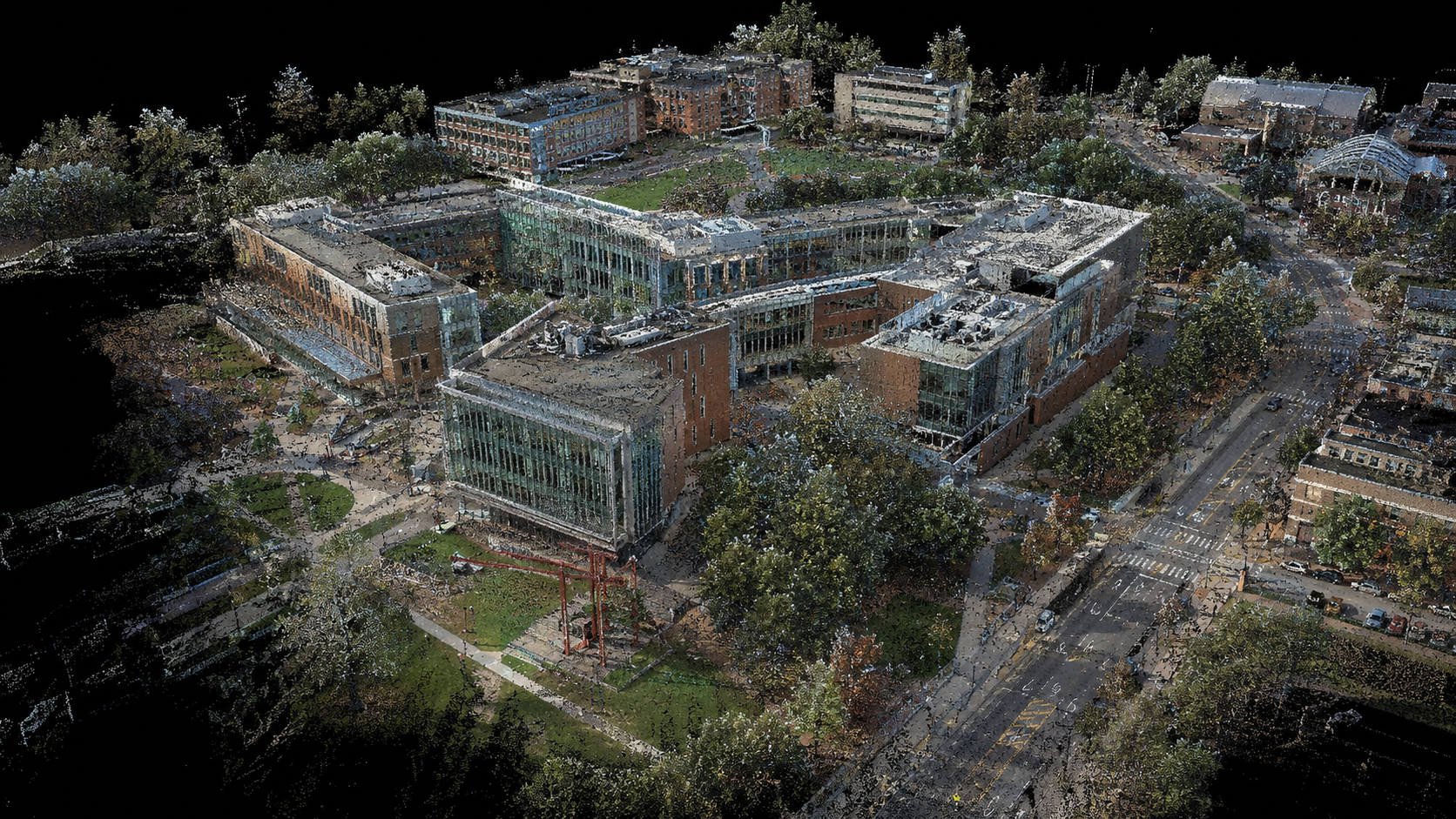
“Vision is the process of discovering from images what is present in the world, and where it is.”
Source of truth documentation.
Build with accuracy
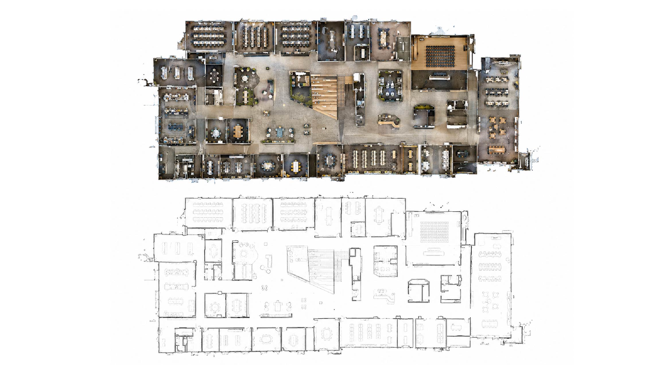
Processed high-resolution photography records a building or site as a measurable digital twin model that provides geometry, dimensions and volume measurements as they exist in the field.
Build for the future
Every image becomes a permanent digital archive that reduces guesswork and saves time. Teams get first-hand documentation they can share, measure, and reference for future projects.
Equipment & Technology
- FAA-compliant drone operations
- High-resolution imaging systems
- Thermal cameras
- Lidar 3D scanning
- As-built digital documentation
- Secure digital delivery systems
Aerial & Ground Documentation
Drone flights and on-site capture work together to document roofs, façades, interiors, and surrounding sites with first-hand field documentation, replacing the inconsistency and unreliability of standard walk-throughs.
Typical engagements include as-built visual records, scheduled construction monitoring, roof and envelope inspections, interior space audits, thermal analysis, and quantity takeoffs from segmented imagery. Each project is scoped and delivered for owners, developers, contractors, and facility managers.
Core Services
From existing conditions capture to segmentation and quantity takeoffs, four focused capabilities for documenting and planning your building.
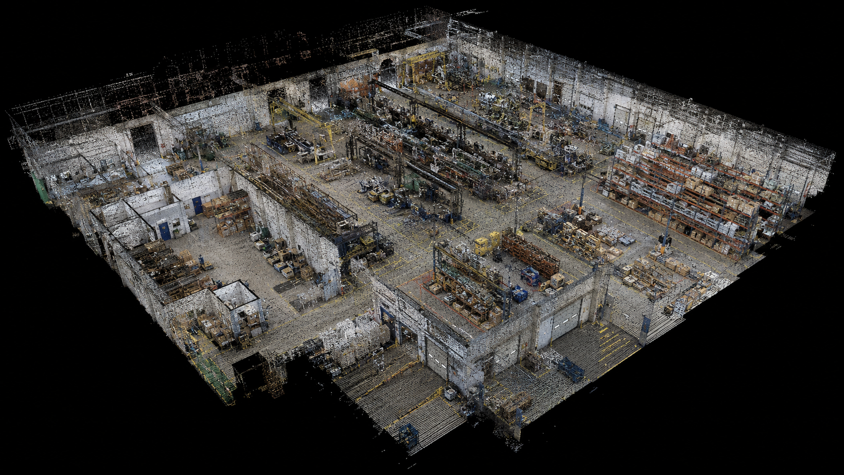
Existing Conditions Documentation
Accurate as-built visual records from aerial and interior capture.
- High-resolution aerial photography
- Interior space audits
- 3D mapping and photogrammetry
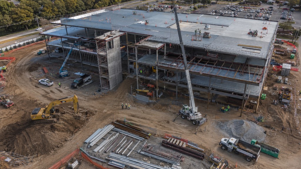
Construction Imaging & Monitoring
Scheduled progress documentation and stakeholder-ready visuals.
- Progress tracking
- Scheduled documentation reports
- Before-and-after comparisons
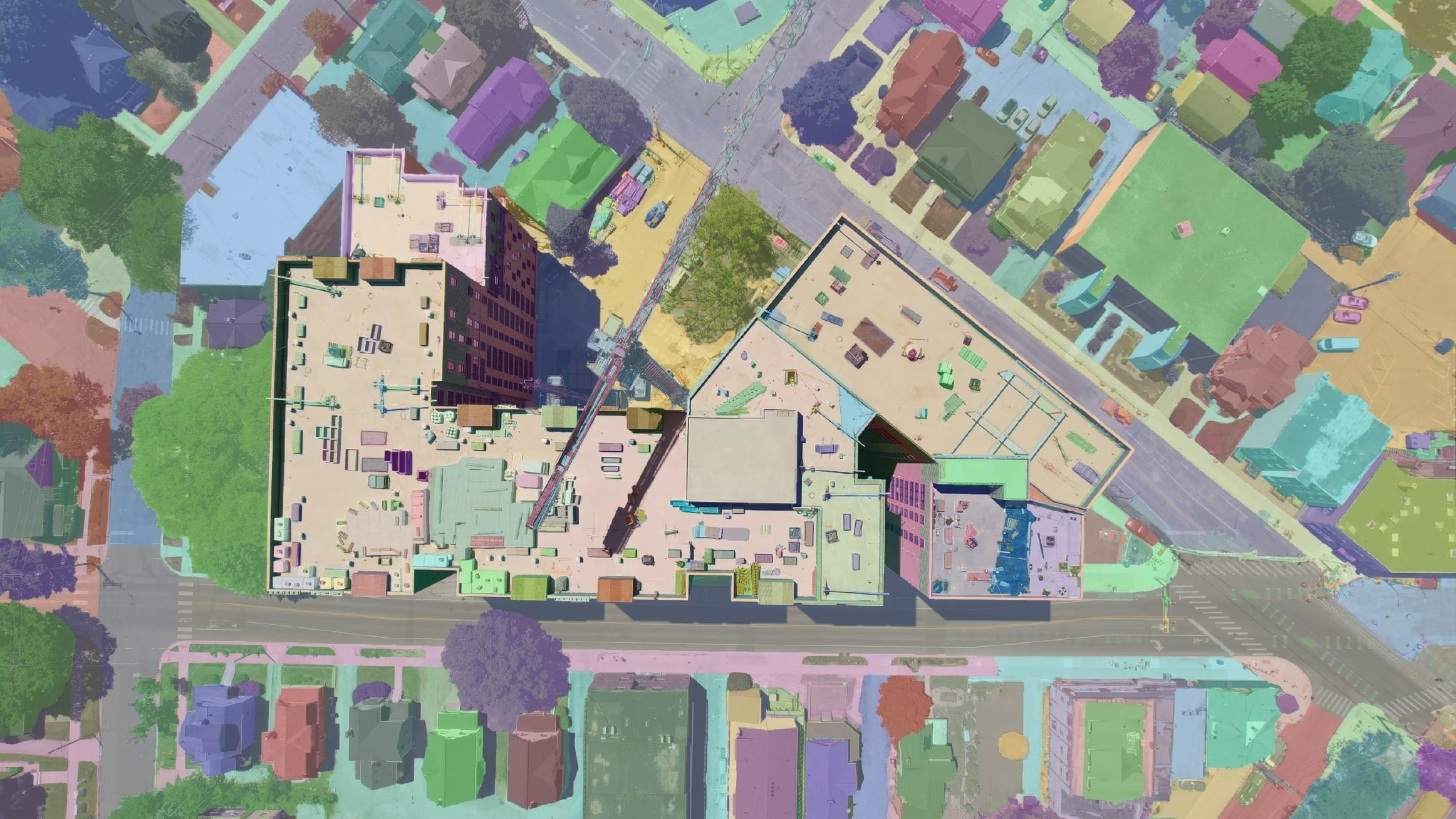
Object Segmentation & Quantities Documentation
AI-assisted segmentation and quantity takeoffs from site imagery.
- Automated object and feature segmentation
- Area, linear, and volumetric quantity takeoffs
- Export-ready reports for estimating and planning
Data-Driven Planning
Visual records that support capital planning and maintenance.
- Visual reports for capital planning
- Asset condition archives
- Maintenance prioritization support
Questions and Answers
What services does Air Link Imaging provide?
Air Link Imaging provides visual documentation and digital site intelligence for buildings, properties, and construction projects. Our services include, but not limited to, existing conditions documentation, high-resolution aerial imaging, construction progress monitoring, roof and façade inspections, object segmentation, quantity documentation, LiDAR scanning, 3D mapping, and planning support.
What is LiDAR and when is it useful?
LiDAR uses laser-based measurement to capture accurate spatial data about a building or site. It is useful when a project needs measurable 3D documentation, existing condition records, as-built references, or detailed spatial analysis.
Do you provide 3D models or mapping deliverables?
Yes. Depending on the project scope, we can provide 3D mapping, photogrammetry-based models, LiDAR point cloud documentation, site imagery, annotated visual reports, and organized digital records for future reference.
Can you document a building before, during, and after construction?
Yes. We can capture existing site conditions before work begins, provide scheduled construction progress documentation during the project, and create final visual records after completion. This helps owners, contractors, and project teams track change, communicate progress, and maintain a reliable project archive.
How quickly can a project be scheduled?
Scheduling depends on project scope, weather, site access, and airspace requirements. Once we understand the project needs, we can recommend the earliest available capture window and timeline for deliverables.
Start a Project Conversation
Tell us what you're working on and how we can help!